Podcast: Play in new window | Download
Lightning struck wind turbines in the U.S. over 77,000 times in 2023 alone. Vaisala Xweather Insight experts detail how their advanced National Lightning Detection Network tracks each bold strike in real-time. Learn how wind farm operators tap into this data to optimize turbine safety and uptime during fierce storms.
Visit their website: https://www.xweather.com/ and read the report!
Sign up now for Uptime Tech News, our weekly email update on all things wind technology. This episode is sponsored by Weather Guard Lightning Tech. Learn more about Weather Guard’s StrikeTape Wind Turbine LPS retrofit. Follow the show on Facebook, YouTube, Twitter, Linkedin and visit Weather Guard on the web. And subscribe to Rosemary Barnes’ YouTube channel here. Have a question we can answer on the show? Email us!
Pardalote Consulting – https://www.pardaloteconsulting.com
Weather Guard Lightning Tech – www.weatherguardwind.com
Intelstor – https://www.intelstor.com
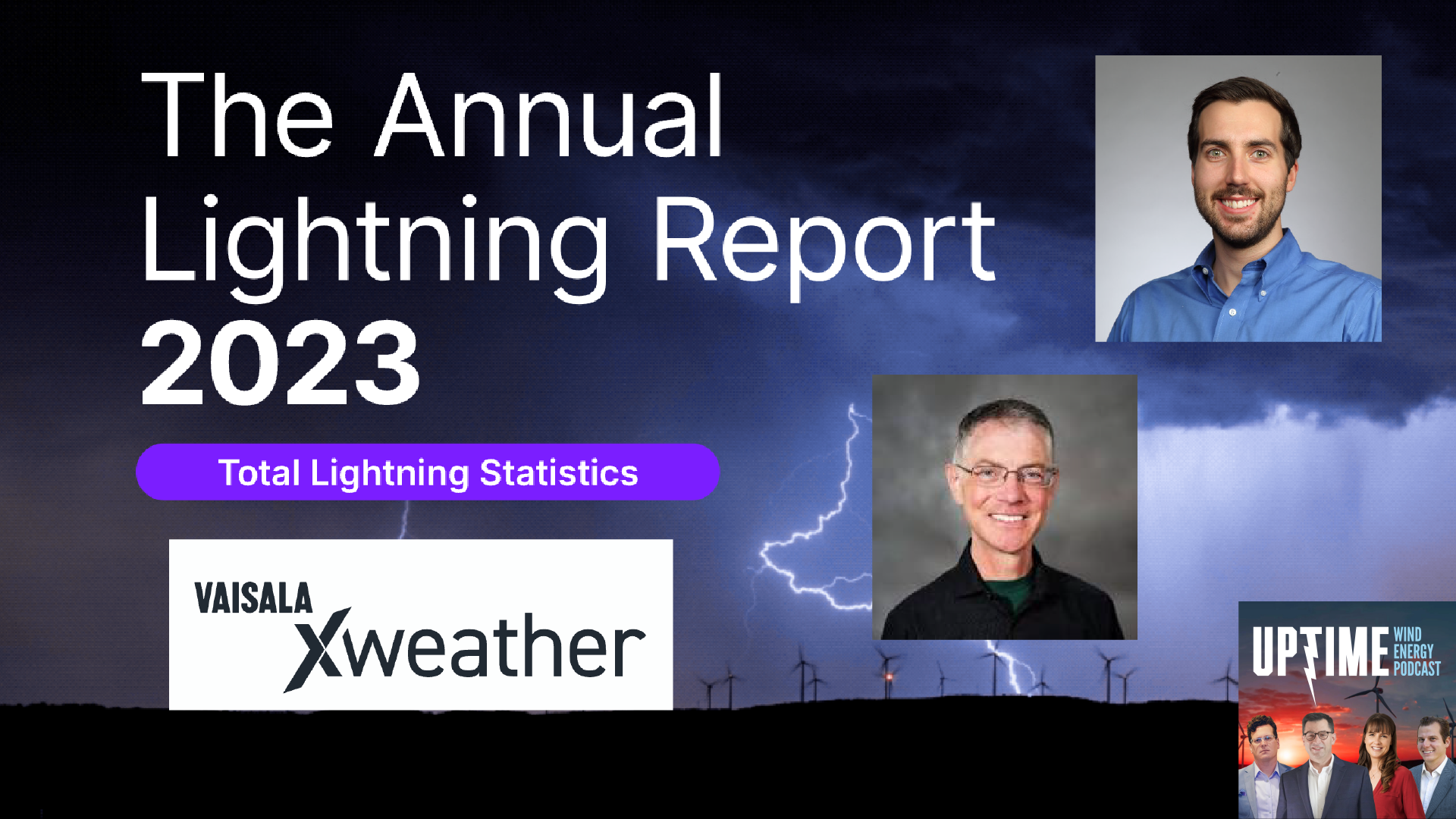
Allen Hall: Welcome to the special edition of the Uptime Wind Energy Podcast. I’m your host, Allen Hall, along with my co host, Joel Saxum. Vaisala just published his 2023 lightning report, and if you haven’t seen it yet, better get online and check it out. One of the key items in that report is 77, 000 lightning strikes occurred to wind turbines in the U. S. in 2023.
So we thought it’d be a pretty good topic for a podcast because we’ve, Joel and I have seen a lot of lightning damage across the United States and 77, 000 lightning strikes is probably one of the reasons why. And if you’re not familiar with Vaisala, Vaisala is XWeather System, which is where that data comes from is in advance, whether intelligence platform provides businesses and organizations with accurate real time.
Weather insights and a lot of sites that we go to, Joel and I go visit, have the XWeather system. And that system integrates data from multiple sources into a sort of a unified view and analyzes current and historical trends and generates hyper local forecasts using artificial intelligence. And as part of that XWeather system is the National Lightning Detection Network, NLDN.
And we’re going to use that acronym throughout this podcast. The NLDN is a network of over a hundred ground based sensors across the U. S. that detects cloud to ground and cloud to cloud lightning strikes in real time. That system is operated by VISLA, and it uses sensors to pinpoint lightning strike locations, polarity, amplitude, and other key characteristics like specific energy.
And that network provides critical lightning data for early warning systems, research, and weather sensitive operations like wind turbines. With a detection efficiency over 90 percent nationally, the NLDN sets the standard for accurate real time lightning detection and mapping. Our guest today, we have two of them, Martin Murphy, Senior Scientist at Vaisala.
And Martin has a degree in meteorology from Penn State and a PhD in atmospheric science from the University of Arizona. And he has worked with Vaisala and its predecessors for over 27 years. One of his focuses is on analysis and validation of lightning detection systems, and he’s a co author of two patents related to lightning detection.
Martin, welcome to the program.
Martin Murphy: Thanks
Allen Hall: And Hans. Hans is the Vaisala product manager for Xweather, and we’ve had Hans on the podcast before, and we see Hans at all the trade shows across the United States. So Hans, welcome back to the show.
Hans Loewenheath: Thank you. Thank you for having me.
Allen Hall: So guys, I want to dive in first into the NLDN.
And since Martin’s here, I want to understand Or explain to everybody what the system is, because we travel around the United States quite extensively, and we meet with a lot of operators, and when we say, did you check the NLDN, the National Lightning Detection Network, they kind of go, what? What is this thing?
Joel Saxum: You get these glass, glassy eyes, like, what are you talking about?
Allen Hall: But it’s an immensely valuable resource, not only in the United States, because there’s a global lightning detection system, too the NLDN, though, has been around a long time, 40 plus years. And Martin hasn’t been there the whole time, but he’s been around in a long time.
So Martin, you want to just describe what this system is and sort of what it does and why we care so much about it?
Martin Murphy: Yeah so the as you mentioned earlier, the NLDN is a collection of over a hundred sensors just within the continental U. S. And these sensors are basically radio receivers that just sit there and listen for particular signals that are emitted by lightning discharges.
And then it filters out other things that are not related to lightning discharges. And and that’s done at the level of the individual sensors. When the sensors find something that looks like it came from a lightning event, they measure all kinds of parameters. They measure a time of arrival, when the signal got to the sensor.
They measure an angle of arrival. They measure a peak amplitude and a number of other characteristics of the signals that we receive, and then each sensor, when it sees one of these, it ships it back in near real time to what we call our central analyzing system. And we have a brand name for that, which is the TLP, but it’s essentially a central analyzing system that collects in all the data from the more than 100 sensors as it comes in real time.
And the central processor’s job is to figure out which sensors saw which lightning events at the same time. And then use all the measurements from the different sensors that saw them, the angles, the times, the amplitudes, to determine the position of the lightning discharge, the time of the lightning discharge, estimates of the peak current, and other parameters that can be derived from that.
And then that all gets done. within about 15 seconds or even a little bit less now of when the actual lightning occurs and then it is delivered to the end users. And we do all of that from a couple of different data centers and then the monitoring of the system to make sure that it stays up 24 7, 365.
99. 99, et cetera, percent uptime is actually done here at our office in the suburbs of Boulder, Colorado. And in fact, upstairs from me is what we call our Network Operations Center or NOC. And the NOC is where all that activity takes place.
Allen Hall: So the NLDN, when it first started, was a relatively simple system because when you get down to the fundamentals of it.
Each little sensor is basically two antennas at 90 degrees to one another. Is that essentially it? Is that it’s picking up the lightning signal that’s rushing to it. It’s just like when you’re driving down the road with, you have AM radio on. I don’t know who has AM radio anymore, but when you hear that crackling noise in the AM radio, it’s like, oh yeah, right?
So it’s picking up that crackling noise in that signal, in that frequency band. But those two antennas help to locate, like, generally locate which direction that thing is coming from, and then because you have multiples of them, that you’re able to triangulate where that signal comes from.
And then, on top of it, it gets to then process, like, what the amplitude of that thing is. Is that the real core fundamentals of it? But that started a long time ago. That system has evolved. And when I walk through, like, what that system looked like originally?
Martin Murphy: Yeah and so originally, 40 plus years ago, 45 years ago, when the first sensors were actually developed in the late 1970s, they literally were just two antennas at 90 degree angles to each other.
And all they could measure was the angle of arrival of these little, crackling signals in the, kind of that AM frequency range, or, even lower in frequency than that. As time went on, especially once GPS became widely available, We could add in time of arrival and do it very accurately.
And time of arrival actually turns out to have advantages because the position accuracy that you can get out of time of arrival is less dependent on the distance that you are away from the sensors. And so adding the time of arrival and the angle of arrival information together was a big advantage to the development of the NLDN.
So, in the, so going all the way back to the beginning. In the late 1970s to around 1980, there was a network of just the angle measuring sensors that covered basically the western third, roughly, of the continental U. S. and Alaska. And that was developed for the Bureau of Land Management to look into forest fires generated by lightning.
And then, shortly after that, kind of toward the 1980 time frame, 1979 the National Severe Storms Laboratory and the National Severe Storms Forecast Center in Oklahoma became very interested. Because, obviously, severe thunderstorms, a lot of lightning, there’s a good reason to want to try to study these things and find out if there are patterns.
And so they did some projects in the early 80s, late 70s, to use small networks of these direction finding sensors, because they still didn’t have the time measurement in them yet at that time. And then, later on not much later on, like 81, 82 some sensors that were originally deployed in one of those field campaigns were moved to upstate New York because some researchers at the State University of New York, Albany, were getting very interested in lightning and also the capabilities of detecting lightning.
And over time, that system got merged with a a small network of direction finders that was owned and operated. I think it was NASA Wallops Island Flight Facility in Virginia. And that eventually grew into what was called the East Coast Lightning Detection Network. And then later in the 1980s, all these groups started talking to each other and said, Hey, can we build out a full U.
S. wide National Lightning Detection Network. And so by late 1988, I think, is when they had it fully ready to go. So I think 1989 was the first year when the complete continental U. S. was covered with NLDN.
Joel Saxum: So, Martin, I got a question for you on that just on that respect. So, we say right now, the complete continental United States covered by NLDN, right?
Over a hundred sensors that are out there. Is there any places, and I’m looking at range and this kind of thing, right? Because there’s a lot of remote places in the United States as well. And we’re starting to see with some of these big transmission projects, Wind farms being installed in remote places, like one that comes right to mind, that SunZia project down in New Mexico.
It’s in the middle of nowhere. Same thing with the the big project, the Sierra Madre Chokecherry up in Wyoming. That project is, it’s gonna be a thousand turbines, but it’s in the middle of nowhere. Are there any places in the U. S. where you would say, Hey, we feel more accurately the NLDN can characterize and position lightning here?
then say here or this is a gap or is there any of that kind of going on? Or do you say, Hey, basically universal coverage at the same accuracy level across the country.
Martin Murphy: Yeah. The great thing about these the frequency range where the sensors operate is that the signals that are generated by lightning.
propagate over the surface of the earth. And so we have to take into account, we have to apply corrections to the time measurements and the angle measurements to take into account measurement errors, but that doesn’t limit the coverage. So you can have a lightning strike that’s in the absolute middle of nothing in, Wyoming or Montana, and it will be seen by, upwards of 20 sometimes sensors that are in various other places around the U.
S. In fact, the highest amplitude lightning discharges might be seen by more than 30 different sensors. So you could have an event that’s in Montana and a sensor in Oklahoma or Missouri will capture it. If it’s high amplitude enough. So we really don’t have to worry about non uniformity too much in this, in that regard.
Joel Saxum: For the listeners out there, I want to give an idea. This is something that was taught to me a long time about positioning. So, positioning these lightning strikes. Imagine yourself, a lot of us are sitting in a room or in a car or whatever right now. And take take your head. And tie a string to it, tie a string to your hat, and you put it into the corner of the room over there, and the corner of the room over there.
If it only seemed by two sensors, you can, and tie that string in, you can still move your head. Once you tie in a third one, and then if you were to say, hey, this is the direction they came from, now all of a sudden you can’t move your head very much. Tie in a fourth and a fifth one, and all of a sudden, you’re pinned right down, right?
That is how the lightning detection network works. That will position these things from seeing him from multiple sensors.
Martin Murphy: Pretty much. That’s a, that’s an interesting analogy.
Joel Saxum: It was a GPS teacher a geomatics professor that taught me that one.
Allen Hall: The more sensors, the better. Well, and because we have someone like Martin on the scene, and Ryan, his co his partner in crime there, Vaisala that are doing a lot of the research behind Lightning, you have brains And universities behind this for a long time, right?
So there’s Arizona was involved, right? University of Albany, SUNY Albany was involved, and a lot of researchers, Oklahoma. Was involved, obviously, because of the weather, so not only has the system developed on the sensor side, but the brains behind it about understanding how lightning signals propagate and the intricacies there and how to adapt to the.
The resistance of the earth and those kind of weird effects has all been incorporated already. That’s all done.
Martin Murphy: That work is, has been done over the last 40 plus years.
Allen Hall: So now we have a system that is working nationwide and there’s a global system that basically does the same thing. But because it’s been there for 40 years, the accuracy is really high.
And I don’t think people understand what that system will generate. Because the latest generation that I’ve worked with or seen, it’ll tell you what the amplitude of a lightning strike is. It’ll tell you the polarity, right? That is correct. How does it do that? How does it know and how accurate is that?
Martin Murphy: The amplitude is? So the amplitude is basically determined by the addition of some more things beyond the original two two crossed loop antennas. So then. There was a third antenna, which is an electric field antenna, which is basically a flat plate that sits on top and that’s how you determine whether it was positive or negative.
And that is accurate to, 99 plus percent because there’s, there’s really not much work involved in determining the polarity. The amplitude is seen by each individual sensor at different distances, of course, because they’re all, in different places. So the first step that we have to do to deal with amplitudes is apply a normalization.
And the way we do it is pretend that all the sensors are exactly 100 kilometers from the lightning. What signal amplitude would they have measured? And then there are some other correction factors that, that can be applied to that to take into account some of the propagation effects that that, we were just speaking about earlier.
And once we have all of those then all of the different sensors, once we have their normalized amplitudes, we can apply a relationship to get an estimate of the peak current of the lightning stroke. And that is accurate to around 15%.
Allen Hall: Wow, okay, because a lot of instruments that we use on wind turbines are good within like three to five percent typically and with temperature variations that can get a little squirrely too, being within 15 percent is Really accurate for a system that is not directly on the object, like a tower or a wind turbine.
Martin Murphy: It’s not directly there.
Allen Hall: Right. Yeah. So to, but that system as the NLDN over time has gotten more accurate because you learn where the little percentage points lie, right? That you can hone that in. I think today, if you ask an operator in the United States, a wind turbine operator specifically. Like, how accurate could you think you can measure lightning?
They would tell you, probably 50 percent plus or minus. That’s not the case. The NLDN is actually telling you what that strike was, the polarity of the strike and the amplitude of the strike really accurately. So if your wind turbine does take a strike, you will know. What hit it? Almost instantaneously, and the bonus is the specific energy, which is basically the energy that the lightning discharge applies to your wind turbine or building, whatever that is, a specific energy is a little bit different, though.
That’s like a area under the curve kind of number. How do you measure that? And how is that sort of created? numerically in the system.
Martin Murphy: Yeah, so actually that is something that we cannot measure directly precisely because we’re trying to do this stuff from remotely sensed radio frequency signals that don’t cover the complete waveform of the current is obviously necessary in order to get specific energy.
So the way we have to do it is kind of through a back channel. There’s, there are relationships between peak current and specific energy that we can apply. than to make estimates of the specific energy. So these are indirect estimates of the specific energy. And the other aspect of lightning detection from long distances, which we don’t have a complete solution to yet, although we keep working on things, is to try to get the continuing current.
If there’s any continuing current after the return stroke itself, which produces those high amplitude crackly radio frequency signals. The continuing current produces signals that are much different and are not, they don’t detect, they don’t produce signals that are detectable at long distances that way.
So we have to try to come at it from a different point of view. And so those are all things that are ongoing research projects.
Allen Hall: I’ve seen that output and the discussion really gets into is there a lot of continuing current, a lot of energy in this lightning strike, is that a damaging lightning strike or what’s the term there, metal we would melt metal something to that effect.
Which seems to be right. Like I’ve seen damage that has happened in the field. I’ve seen the NLDN’s prediction of it. And that pretty well aligns, right? If it says it wasn’t a damaging strike. That’s pretty much true. So the accuracy in which you’re able to do that with remote sensors is amazing.
To tell you, hey, that strike probably was damaging. You better go look what your wind turbine is to see if it is damaged. Right. It’s an indication of I need to go do something that’s actionable data. And this is where Joel and I have been for the last year about giving operators and owners actionable data.
The NLDN does that today. That is already there.
Joel Saxum: Yeah, looking at this report, right? So when you guys put out the report 2023 Vaisala lightning, you put some extra statistics in there that are very interesting. Specifically, we’re in the wind industry. We deal with lightning, right? So to us, it was like, Oh, like a little piece of candy came out, so we started looking through this thing and some of the most interesting things I saw in here. This is a couple of stats I want to read off. 20, in 20 counties, now we’re not naming specific wind farms because we don’t want to do that right now, right? But in 20 counties in the United States, most of these all in the Midwest or in the that, I call it the I 35 corridor, basically, from Texas to Minnesota.
So, it, there is 20 counties where there’s greater than 5 stroke, lightning strokes per turbine in 2023. And in that data as well, there’s three more counties that took over 10 strokes per turbine in 2023. Now, these numbers are way higher than you usually hear from people. Like, some of those things you hear normally in the world, Ah, average, might take one turbine might get struck once a year, twice a year.
Some people in different areas of the world say one, I’ve heard one strike per lifetime, which is crazy. Maybe, yeah, maybe in areas where there’s no lightning, which, that happens as well, right? It’s different geographically, but the fact that you guys put a bunch of data together, if you’re in the wind industry, and you haven’t looked through this report yet.
Just Google Visalo weather or lightning report 2023 and it will be the first link that pops up and it’s an active PDF you can float through. I don’t, Hans, do you want to talk about this report a little bit, how you guys decided to do some of these things?
Allen Hall: So, because Hans you’re the head of the XWeather system, right?
You’re the product manager for the XWeather system. The XWeather system uses the NLDN as part of its overall weather coverage, right? It’s a bigger scope in terms of, if a storm’s coming. XWeather tells you, and it then adds the NLDN to it. So it’s a really cool system. You want to walk into what this, all this lightning data helps you with in the XWeather system and how that works?
Hans Loewenheath: Yeah, absolutely. So with the NLDN, that’s really the foundation of our XWeather system, along with the GLD 360 Global Lightning Detection Network, where we’re detecting over 2 billion events each year across the world. And with. Both of those lightning detection networks were able to utilize that data both in real time and in archived historical analysis type of use cases and serve those use cases via different APIs or data feeds or software monitoring systems and analysis systems and with this annual lightning report, We’ve been now this is our 7th annual lightning report that we’ve done and it’s something that we’ve all been super proud of, but we’d like to use the report as a way to really showcase.
How you can use this XWeather lightning data and come up with some really interesting insights. Really there’s too many stories to tell. So it’s really hard to edit down the report to actually be something that people want to read it and successfully get to the end of the report. But, with this wind energy analysis, that’s something that we introduced new for this year and we’re really excited about it.
And basically what we did, we just looked at the 2023 data pulling from our API endpoints and analyzed for the more than 75, 000 turbine locations from the USGIS turbine database and looking at cloud to ground only lightning strokes within 200 meters of all of those turbines. And then analyzing that result.
Yep. 200 meters. So there’s, a little bit further distance where, some other events could have. Hit the turbine but that’s, not something we could have said with such high certainty here. So with a little bit more conservative approach here, certainly some of the rankings and values could have been even higher.
But even with that conservative approach, I think that the results are pretty impressive.
Allen Hall: Martin, one of the questions I get asked about the NLDN is it can determine if a lightning strike has happened, but it doesn’t know how many times it has been, how many strokes it had. In a negative lightning strike, there tends to be multiple strokes, right?
And they’ll say, well, it’ll tell you the first stroke, but it won’t pick up all the rest. That’s incorrect, right? That system knows every piece of lightning current that has entered that wind turbine. Correct?
Martin Murphy: The the NLDN measures individual strokes. Now, they are grouped into the flashes that they came from, but the fundamental measurement is individual strokes.
Allen Hall: The discussion in the industry at the moment, Martin, I’m going to bring you into some inside baseball in this crazy wind turbine world that we live in, is that, well, these upper lightning strikes, no one can detect those. Wrong. That is wrong. And I’ve looked at data over the last year that NLDN does it just fine.
Right. If there’s, if there is an impactful lightning strike, when I say impactful, I mean, there’s more than a couple of thousand amps, like two, two Ka, two kilohamps going into a turbine, NLDN picks all that up. And it’ll pick up multiple turbines reaching out to the sky simultaneously. It clearly does that.
So the discussion, your NLDN system or in which you’ve helped develop over a number of years. It’s doing a wonderful job of picking up lightning strikes to turbines, upward and downward. It just doesn’t have to pick up these little faint wisps of quote unquote lightning that happen to the sky, because nobody cares.
It only matters if, and Joel, this is our discussion, it only matters if something happens, like there’s a significant amount of energy being deposited, then Martin’s system says, yeah. There’s been a stroke there. It does do that. So Martin, I, you may be getting a little bit of a bad rap here because people don’t know.
And this is why you’re on the podcast is because I want them to hear from the guy himself. It does the magic.
Martin Murphy: It does. Yeah.
Hans Loewenheath: You mentioned that the two kilo amp mark is, kind of something that the NLDN can really pick up. We designed the NLDN with a really consistent and even distribution of the sensors across the contiguous or continental United States.
And that allows us with our really exceptional sensor technology to pick up these events and do so in really remote locations. Martin, I think you’ve done some analysis as far as some of those minimal detectable peak currents across the United States, anything that you can share from that?
Martin Murphy: Yeah, actually we did a couple of years ago we had a request from another research group to see if we could give them an idea of what the minimum detectable signal level is in the NLDN, and so basically what we did is just took all of the lightning events from three or four year period and across the continental U. S. Gridded them on some, 10 or 20 kilometer by 10 or 20 kilometer grid, and in each grid box we looked at the lowest 5th percentile and maybe even the lowest 1st percentile of the peak current amplitudes that were being detected. And just plotted it across the entire country to see how uniform it is.
And it’s pretty uniform.
Joel Saxum: So you weren’t picking up a bunch of people arc welding or anything?
Martin Murphy: We weren’t going quite that low.
Joel Saxum: It wasn’t like there was a pipeline project here and you could see a line of welders going down it?
Martin Murphy: Not quite that level of sensitivity.
Allen Hall: Yeah, but it picks up everything that we care about in the wind world.
And it’ll pick up things that are above 200 kiloamps. I’ve seen data that says. It’ll pick up big, those big rare strikes, but big strikes, right?
Martin Murphy: Yes, it’ll pick up the rare big ones.
Allen Hall: It’ll do everything that, I don’t know, on a wind turbine that we care about today. And this is a odd discussion that’s happening in the wind community at the moment because they’re just now awakening to the fact that there’s a system out there that’ll do everything that they want and they just need to tap into it.
And this is part of the XWeather Insight system, right?
Hans Loewenheath: Yeah, absolutely. So with XWeather Insight, we launched that earlier this month in January at the Consumer Electronics Show. And XWeather Insight really is a weather confidence platform enabling users to, really optimize their safety and efficiency for.
For their daily operations and within the protect module specifically, users are able to, tap into that XWeather lightning network with the NLDN or the GLD 360 and configure their own real time lightning alerts for, actual lightning events detected in relation to, their relevant locations or assets like a wind farm or, okay.
Even individual wind turbines. And then you can also set up alerts on the forecast for lightning. So, for technicians out there up in, up tower, right? So not only can you look at, where the actual events occurring right now and how far are they away from where I’m at, but you can also get an alert on how far in advance is lightning likely to occur within my, threshold distance here that, okay.
Got it. I’ve got 30 minutes here, I think, before I need to, come down tower.
Joel Saxum: Allen, and I, like I said, we talk to a lot of operators out there, all over the world. Every one of them by an HSE, health standard, safety standard needs to have some kind of weather alert service. They have to have it.
It’s a no brainer, right? You can’t be sending people up tower without weather stuff. But now that you’re able to forecast this. So this is the way, this is one of the things that pops up a lot. You have asset owner one and you have an independent service provider who’s working on their turbines.
And at the end of the day, and this is a weird thing, right? But at the end of the day, someone’s going to get billed for the downtime. So this is one of the things that keep keeping people safety safe is the most important thing, of course, in the field at all times. So having the ability to forecast when these people, Hey, we may have lightning in an hour, get off the blades or get out of the nacelle.
That’s fantastic. That’s tier one, right? But at the end of the day, there’s also some really interesting things you could do here to, to proof. You’re billing. This is a, I know that’s a weird thing to say, but like, Hey, if I had this many hours where we had lightning within this area, that’s downtime that you got to pay for my people.
I think that’s a very valuable thing for any independent service provider or on the opposite side, the asset owner, the person paying the bills to go back against and QA, QC, what that accounts receivable looks like.
Hans Loewenheath: With this system, yeah, you can have an accurate record of, when things have happened when the storm has left the area and, really make those comparisons I think that the trouble comes in when you’re looking at two different systems that have, different detection capabilities obviously we’re biased with the National Lightning Detection Network in our XWeather systems but we pride ourselves on high detection efficiency and picking up every storm.
Allen Hall: In the U. S., I think the thing we’re running across, Joel, is that these farms are so large that maybe a storm on one part of the farm and not on the other. It is getting insane. And with Sunzea, that’s going to be the case down in New Mexico, clearly, right? That this farm is so big that it’s covering a couple hundred square miles.
Joel Saxum: Size of a wind farm. Allen and I were driving in the Midwest, Kansas, Oklahoma the other day. And I, we were driving and it started to get dark out and I could see some things in the distance. I said, I think that’s the wind farm we’re going to. And I looked at the clock. When we got to the wind farm, it was another 43 minutes.
Right? We could see that thing for, that’s how big it was. And then once we got into the wind farm, we drove for another 15 minutes before we went through it. Like, this is the size and scale of these things.
Allen Hall: So having an accurate prediction on where the storm is going does help out the operator tremendously, and the technicians.
Martin Murphy: It is a thunderstorm tracking method that literally just uses the individual lightning events. But we have to do some preprocessing to do the flash clustering, like we were talking about, the multiple strokes going in the same flash and where are the cloud lightning events coming from, making sure that we’re getting the storm centroids as accurately as we can, and then following their motion over time so that we can produce an accurate estimate or as, as accurate as we think we can of the projected future.
Trajectory of the storm. And then the, another thing that we do inside the lightning threat zone algorithm is we monitor what the activity appears to be doing in terms of whether it’s there’s a potential of growth or decay of the thunderstorm. And decay is actually quite important because we don’t want to issue a forecast that says you’re going to have lightning in an hour if the thunderstorm is going to be gone in 10 minutes.
So the idea is to try to stop the algorithm from over forecasting. Thunderstorms as best we can.
Allen Hall: The storms in different phases have different lightning threats, correct? There’s the I’ll give you the example that everybody brings up the bolt out of the blue that’s a phase of a thunderstorm right where those tends to happen.
Martin Murphy: It might be associated with a phase or it may just be the particular charge structure of the thunderstorm.
Allen Hall: You’re using the lightning data what’s happening internally inside the clouds To then help predict, like, where the center of this thing is, direction it’s moving, and how it’s progressing.
Hans Loewenheath: And we can do that just with the lightning information, so offshore, onshore, we can provide this technology to any current or future wind farm that might need this service. And there’s no, no radar or no other information needed for that.
Allen Hall: So there’s new wind farms that are being built off the East coast of the United States.
You got them covered already.
Hans Loewenheath: Absolutely.
Allen Hall: They’re in a strong lightning zone. Martin, am I wrong about that? Off the East coast of the United States and those, and just not very far offshore. It’s some pretty strong lightning.
Martin Murphy: Yes, there can be a lot of thunderstorm activity over there.
Hans Loewenheath: Yeah, and then you throw in a helicopter and some of that activity in the storm, that’s that’s not a situation you necessarily want to be too close to.
Allen Hall: So if one of those offshore wind farms or the onshore wind farms in the United States or even globally wanted to learn more about XWeather Insights and all the NLDN things. Where do they go, Hans?
Hans Loewenheath: Yeah, first place is xweather.com. And from there you can navigate to the XWeather Insight Platform, ask for a demo, we can get people set up with the trial today.
And you can also check out the annual lightning report there from the homepage of xweather.com.
Allen Hall: And if they want to tap into Martin’s brain, can they connect to you on LinkedIn, Martin?
Martin Murphy: I am on LinkedIn, yes.
Allen Hall: Just look up Martin Murphy, Vaisala. Yeah, he’s a busy guy, clearly a busy guy. But if you have a really interesting lightning question, I think he may be able to answer for you and Hans can do the same thing, too.
Because where else do you go today? You got to go to the experts and that’s why we have the podcast is to highlight these people that are doing the good work behind the scenes and to make sure everybody stays safe out there. So Hans, Martin, this has been fantastic to have you on the program.
And we’re going to have you back soon because lightning season’s coming. So we’ll as we progress through, we’ll have you back on. Let’s see how it’s going. We’d like to just get an update as what lightning to wind turbines looked like in the U S and around the world. So thanks for being on the podcast.
Martin Murphy: Thanks for inviting us.
Hans Loewenheath: Absolutely. Thank you for having us.